Photographs by Frank

9 October 2022

Foliage / Edges

Filed under: Autumn,Landscapes — Tags: — Frank @ 3:00 PM

Yesterday, I attended a NH Society of Photographic Artists print sharing event in Concord. The meeting was ninety minutes long and the drive about 45 minutes each way. I left the house before seven in the morning and returned home just before five in the afternoon.

My “excuse”…The foliage is roughly peak and I meandered both to and from Concord!!!

[scrollGallery id=890 – autoscroll = false width = 600 height = 600 useCaptions = true]

30 June 2022

Monhegan Island – Surf

Filed under: Landscapes — Tags: — Frank @ 4:00 PM

Where ocean meets land there is surf. Islands are well endowed with surf watching opportunities. I took advantage of those opportunities and made many, many photos of the surf over the week we visited Monhegan Island.

[scrollGallery id=878 – autoscroll = false width = 600 height = 600 useCaptions = true]

[scrollGallery id=877 – autoscroll = false width = 600 height = 600 useCaptions = true]

28 June 2022

Monhegan Island – The Shoreline

Filed under: Landscapes — Tags: — Frank @ 11:00 PM

During our week on Monhegan, we hiked most of the trails in the conserved ‘wild’ section of the island which is owned and managed by the Monhegan Associates, a private land trust. This is not difficult to do as the island is less than two miles long and less than a mile at its widest. There are a total of eleven miles of trails (trail map as a pdf file).

In doing this we saw essentially all of the shoreline. All of the shore is rocky and most of it is very steep. There are several headlands where the cliffs drop directly into the water.

Again, I made many (too many?) photographs of the shore line from many different vantage points. Here is a baker’s dozen that it hopefully varied enough to hold your attention.

[scrollGallery id=873 – autoscroll = false width = 600 height = 600 useCaptions = true]

Monhegan Light

Filed under: architecture,Landscapes — Tags: — Frank @ 10:00 PM

The lighthouse on Monhegan Island is an interesting (in that it is unpainted stone) but not particularly tall (at 47 feet) structure that can be seen from many vantage points in the village. The structure does not need to be particularly tall because it sits at the high point of the island putting the beacon at 178 feet above the water.

As with so many lighthouses, the beacon has been automated. Thus the “surplus” structures including the keepers house has been turned into a museum. We were glad to visit and learned much about both the cultural and natural history of Monhegan.

Also present on the grounds of the lighthouse is the original, hand-struck, bell from the Manana Fog Signal station. This Wikipedia article is a bit out of date as it does not state that the facility was decommissioned in 2014. The bell stands roughly five feet high.

I made numerous photos of the lighthouse from many vantage points around the village and at many different times. Here is a very few of them.

[scrollGallery id=872 – autoscroll = false width = 600 height = 600 useCaptions = true]

5 May 2022

Weathersfield Center (again) and Baltimore, Vermont

Filed under: Landscapes,Misc.,Spring — Frank @ 11:17 PM

Back at the end of March, I visited Weathersfield Center, VT for the first time and discovered the wonderful meeting house there. After this excursion, I looked at a map of the general area and noticed the nearby town of Baltimore. Joan was born in Baltimore, Maryland and our daughter, Katrina, has lived there for the last fifteen or so years. Thus, I decided that when I next visited this part of Vermont I would go see Baltimore. Today was the day!

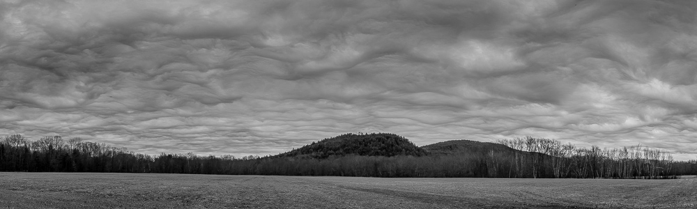
This morning, I taught an introduction to photography tutorial for the Vermont Center for Photography in Brattleboro. After I was done teaching, I pointed my truck north. The weather was pleasantly warm and the skies were partly cloudy.

I stopped first in Weathersfield Center. My first visit there was on a cold, damp day and I used my camera obscura exclusively that day. Today, the light was much more conducive to photography. I made photographs with both the camera obscura and my ‘regular’ camera. I left the images from the latter as color since I like the contrast between the warm orange bricks, the cool azure sky and the green spring grass. I also noticed (and photographed) the nearby town pound* with an interesting iron gate. I had completely missed the pound on my first visit.

After photographing the meetinghouse, I attempted to head towards Baltimore. Notice I said “attempted”… I had either one of those “you can’t get there from here” (use a thick New England accent when you read that!) moments or my map was broken.

Eventually, I got out my phone, fired up its GPS application and, without further drama, found the westernmost end of Baltimore Rd (on VT10 just to the west of the junction with VT106 in North Springfield). Baltimore Road, which is not paved, makes a six mile loop through town. The other end intersects VT106 just north of the junction with VT10. The two ends of Baltimore Road are less than a mile apart!

Roughly half way along this loop one comes to the Baltimore Town Hall (see the last photo below). The (rather nondescript) town hall is the only public building in Baltimore. There is nary church, etc.

Upon arriving home, I learned a bit more about Baltimore by Googling, of course, as any modern guy would do! It turns out that the current population of the town is roughly 230 people, about what it was two hundred years ago (i.e. in the early 1800s) and quite a bit higher than the low of about fifty in the early 1900s**.

The town has a total of 7.2 miles of roads, all of which are unpaved. Just out of the frame on the right of my photo of town hall sits a road grader; my guess is this is only significant asset the town owns other than the town hall.

The town hall was built in 1894 as a one room school house and was used as such until 1988!

In summary, Baltimore is a bit out of the way and on the quiet side, but I am glad that I made the trip. Maybe, I will go back some day and drive the other twenty percent of the the town roads that I missed this time thorough!

[scrollGallery id=851 – autoscroll = false width = 600 height = 600 useCaptions = true]

* Town pounds are small, generally stone wall enclosed areas where wayward livestock were penned up until their owners could ransom them. Loose livestock were a serious matter when most folks depended on their gardens and fields for the bulk of their sustenance and the ‘fuel’ for their horses and oxen. Stray livestock could quickly decimate a garden and thus were rapidly escorted to the town pound before (hopefully) they could do much damage. The owner of the strays would then have to pay a fine in order to retrieve their animals from the pound.

** This pattern is typical for many small towns in New Hampshire and Vermont. Populations peaked in the first half of the nineteenth century when sheep farming was at its peak and declined thereafter as farmers moved to more fertile territory as the mid-west (then “the west”) was ‘settled’. Populations generally reached their lows in the first quarter of the twentieth century and slowly rebounded thereafter. The current population of many small northern New England towns is roughly the same as it was two centuries ago.

30 April 2022

Nasami Farm

Filed under: Landscapes,Spring — Frank @ 11:32 PM

Joan was in need of some plants for the yard. So, today we made a trip to Nasami Farm, the Native Plant Trust’s nursery in the Connecticut River valley village of Whately, Massachusetts.

While Joan selected plants, I wandered the grounds looking for photographs.

[scrollGallery id=850 – autoscroll = false width = 600 height = 600 useCaptions = true]

27 April 2022

Harrisville Details

Yesterday morning I picked up my last load of compost for the season. This final load was destined for Joan’s cousin Suzy who lives near our abode. Since I had no fixed schedule, I meandered vaguely in the direction of home. Of course, I had my camera with me.

As I drove, I noticed the nice texture (at least in some directions) in the clouds and went in search of a foreground for the interesting clouds. I ended up at Halfmoon Pond in Hancock, near the Harrisville border (see the first photo, below). The textured clouds did not last long. The overcast built steadily and it began to drizzle.

Knowing that Joan had to make a trip to Harrisville Designs, and with the lunchtime approaching, I called Joan and arranged to meet her at the General Store for lunch. After lunch Joan headed to the yarn pushers for what she needed and I wandered about the village to make photographs.

Harrisville, NH is a quaint, well preserved old mill town. It is among my favorite places to make photos. Since the weather was not suitable for grand landscapes (think low, thick overcast and intermittent drizzle), I concentrated on the details.

It was almost 5PM before I got the compost delivered.

[scrollGallery id=849 – autoscroll = false width = 600 height = 600 useCaptions = true]

9 April 2022

Five More From Thursday (“Cloud Day”)

Filed under: Early Spring,Landscapes,Monadnock Region — Frank @ 9:00 PM

Here are a few more photographs from my “cloud day” excursion.

The first (“Hedgehog Mountain and Clouds”, is a three frame panorama.

The remaining four don’t feature the clouds quite as prominently (or at all) as the photos I posted yesterday.

[scrollGallery id=846 – autoscroll = false width = 600 height = 600 useCaptions = true]

8 April 2022

Clouds

Filed under: Early Spring,Landscapes,Monadnock Region — Frank @ 10:45 AM

Yesterday morning, I headed to the grocery store. (We were out of the makings of salad for lunch.) However, I got waylaid by the interesting asperitas clouds. We had a rather late lunch.

[scrollGallery id=845 – autoscroll = false width = 600 height = 600 useCaptions = true]

2 April 2022

A Short Detour

Filed under: Early Spring,Landscapes,Monadnock Region — Frank @ 6:00 AM

Yesterday morning I ran errands in Peterborough.

The day was overcast but fairly warm. There was wonderful texture in the clouds.

I could not resist and took a short detour on the way home. Stopping in spots where I knew I could get good views of the sky, I used the camera obscura to make a few photographs.

[scrollGallery id=844 – autoscroll = false width = 600 height = 600 useCaptions = true]

« Newer PostsOlder Posts »

Powered by WordPress